Geology enthusiasts and other nature lovers don't have to search far and wide, as a diverse landscape and nature can be found in the capital region
Reykjavík On The Rocks: Five Geosites in the Capital Region
Fancy rocks over shops? Geology might not be the first thing that comes to mind when thinking of Iceland's capital, Reykjavík, but the fact is that many interesting geological sites are found there.
We hand-picked five locations that reflect the geological history of the capital area. So, geology enthusiasts, you can put your boots on and start exploring!
What is the Reykjavík Capital Region?
Reykjavík is the capital of Iceland but the area known as the Capital Region or 'höfuðborgarsvæðið' includes Reykjavík and its connected neighboring towns: Kópavogur, Garðabær, Hafnarfjörður, Seltjarnarnes, and Mosfellsbær. Seen on a map here. The capital region is not only urban, as there is a considerable amount of land around the urban area that is popular for outdoor activities among residents, such as the Heiðmörk forest and recreational area, Mt Esja, Mt Úlfarsfell and Mt Helgafell.
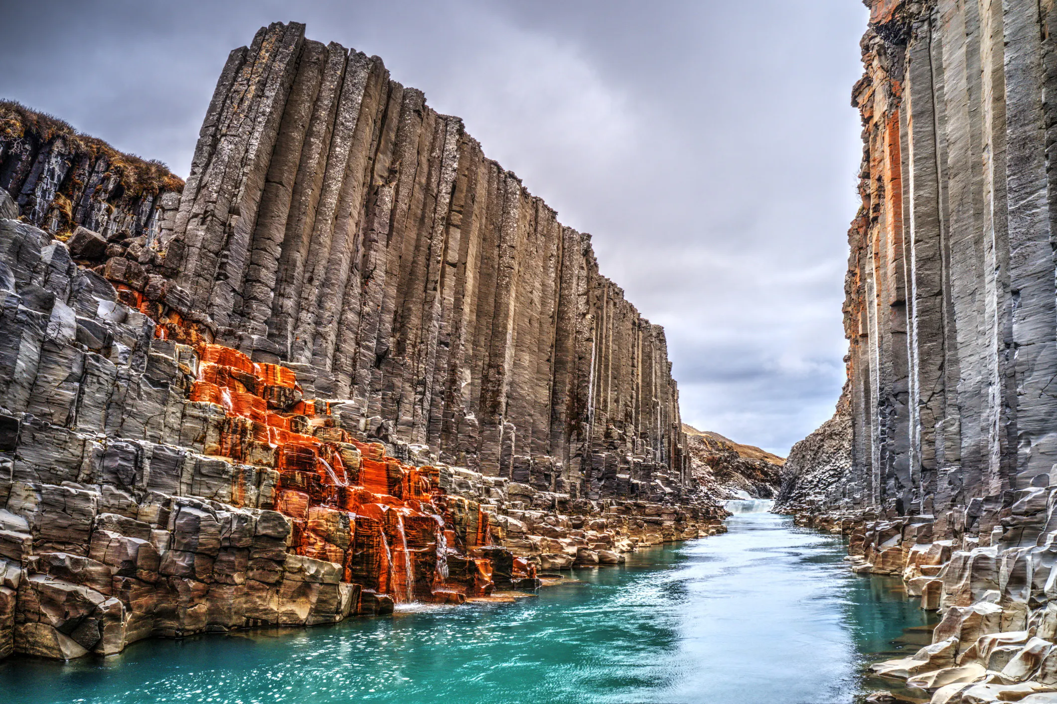
The capital region stands on a bedrock that spans the last 3.2 million years of geological history. The city is on the west margins of the active volcanic belt and the mid-ocean rift zone that runs through the island. Therefore, we both have evidence of fairly recent volcanic eruptions and formations from the current geological epoch called Holocene that spans the last 11.700 years of Earth's history and the last glacial periods (there were several!) of the ice age that ended 10-12 thousand years ago.
The oldest rocks in the capital area are found in Mt Esja and the youngest in the southernmost part of the capital area, where the towns Garðabær and Hafnarfjörður, are partly standing on lava flows from historical times in Iceland. That means they flowed after the settlement of Iceland around 870 AD. The youngest of these lavas is Kapelluhraun (The Chapel lava) from an eruption in 1151 AD; the other lavas in the capital region are between 1100 and 5300 years old.
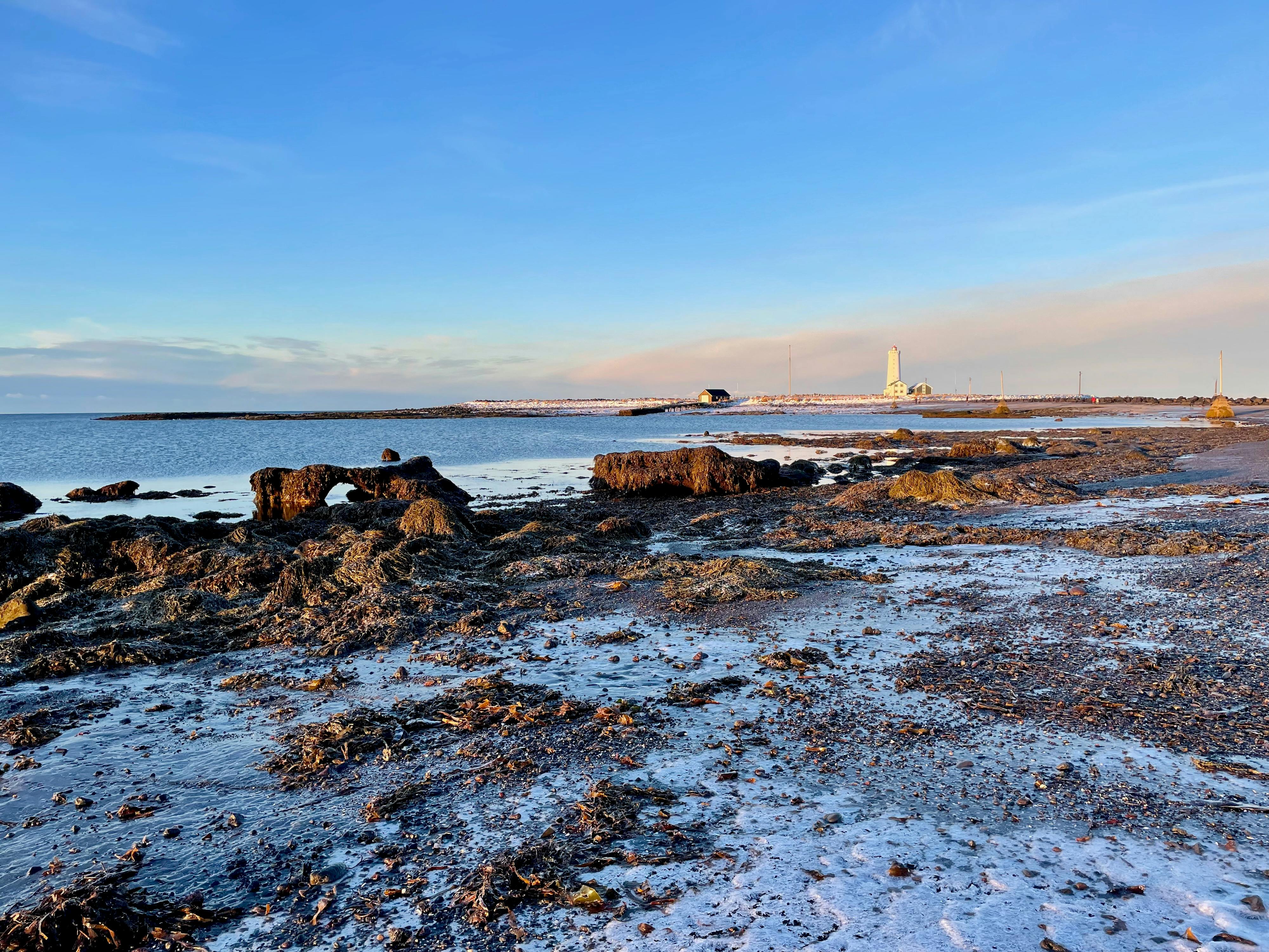
Grótta lighthouse at the Westmost tip of the Capital area is a scenic spot as well as an interesting geosite
1. Seltjörn and Grótta Island Subsiding Landscapes
Location: Parking and bus stop at Grótta.
! Be aware of the tides if you plan to walk the small reef to Grótta island so you won't get stranded.
The area around the Grótta lighthouse at the westernmost tip of the Capital Region offers a panoramic view over the Faxaflói bay to Mt Esja and out the Reykjanes and Snæfellsnes peninsulas. It is also one of the best spots for Northern Lights in Reykjavík as well as a hot spot for birders and golfers. While there you can also dip your toes in the small Kvika geothermal footbath on the beach and stop by at Valhúsahæð geological monument.
In present, the land around the southern part of Faxaflói Bay is experiencing subsidence. Historical records suggest that during the era of initial human settlement, a significant body of water, either a large pond or a lake known as Seltjörn, was present on the Seltjarnarnes peninsula, lending the area its name, Seal-pond-peninsula. Over time, due to the gradual sinking of the land and the advancing sea, this pond evolved into a spacious bay located between Grótta and Suðurnes. Historians believe that up until the 18th century, the Seltjarnarrif barrier enclosed Seltjörn, resulting in its waters being fresh or only mildly saline.
At low tide, unusual peat formations become visible along the coast, protruding from the sand and pebbles near Seltjörn's southern shore. This is a type of coastal peat formed in a once-thriving marsh that is now almost entirely submerged. The peat layer is approximately 1.5 to 2 meters thick and has formed over an extended period. The oldest layers at the bottom are estimated to be around 10,700 years old, while the uppermost layers are about 3,000 years old. These layers reveal that Seltjarnarnes has undergone a subsidence of about 3-5 meters over the past 3,000 years and around 1-1.5 meters since the time of the original settlements.
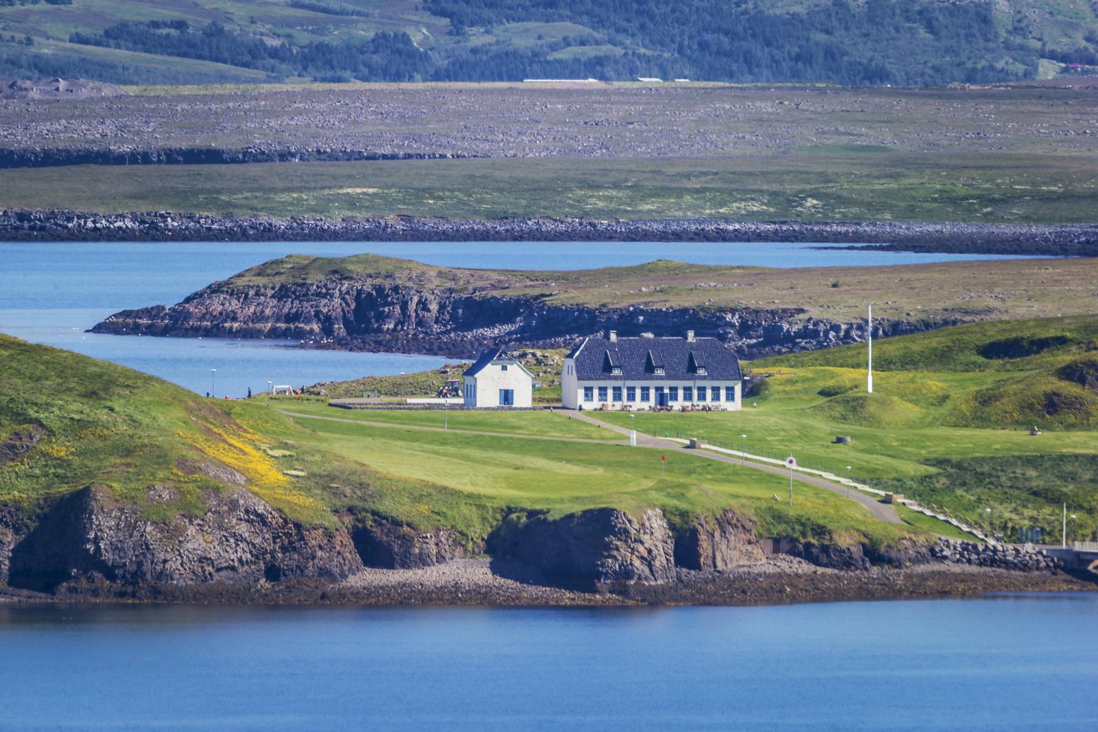
Viðey Island has a rich history and is home to Yoko Ono's Tower of Peace
2. Viðey Island Extinct Central Volcano
Location: A ferry will take you there within 10 minutes from Skarfabakki peer in Sundahöfn harbor. Note that the ferry also operates from the Old Harbor in Reykjavík during the summer. See schedule and prices for the Viðey ferry here.
Viðey Island, a mere stone's throw from downtown Reykjavík, presents a fusion of a thousand years of history, rich nature, and a unique geosite.
Geologically, Viðey is fascinating. The bedrock of Viðey Island is divided into two parts. Its western part features gray stone or dolerite basalt lava from a warm period or interglacial period late in the last Ice Age called ‘grágrýti’ in Icelandic. In contrast, the most prominent geological layers in the eastern part are those formed in connection with the ancient Viðeyjar-central-volcano’s effects, that was active about two million years ago. Widespread palagonite tuff and sedimentary layers are also found in the easternmost part of the island. Intrusive dykes, such as the impressive Virkishöfði, have forced their way into this tuff and now stand as evidence of the extinct central volcano.
Culturally, Viðey is equally rich. It hosts Yoko Ono's "Imagine Peace Tower," a tribute to John Lennon, and is home to Iceland's oldest building, offering a glimpse into the nation's past. The island has been an influential residential area for scholars and leaders, evidenced by the remnants of old farms and gardens. Today, Viðeyjarstofa and Viðeyjarkirkja, historical buildings, are open to the public, with a restaurant serving visitors.
With an area of about 1.7 square kilometers, Viðey is an ideal destination for nature enthusiasts. It's a renowned birdwatching spot, hosting species like eider ducks, gulls, and geese, especially around the protected Þórsnes area during the breeding season.
Viðey offers a serene escape from the city, inviting visitors to enjoy its tranquility, natural beauty, and historical ambiance.
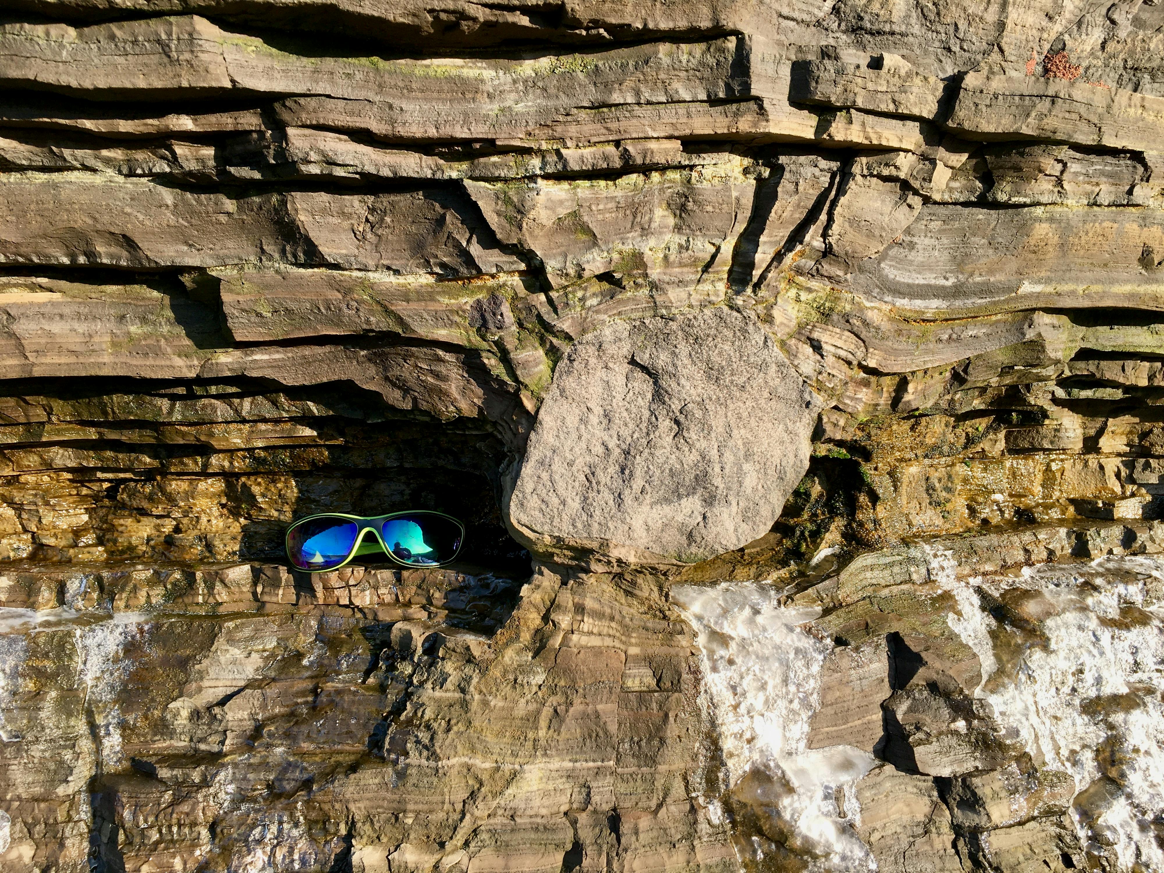
The Fossvogsbakkar strata exhibit intriguing features, such as dropstones that fell into the ocean floor sediments from melting ice rafts
3. The Fossvogsbakkar Strata
Location: The coastline of innermost Fossvogur bay between the Nauthólsvík Geothermal Beach and Fossvogslækur creek. Best to visit at low tides.
The Fossvogsbakkar is a protected geological monument and some of the best-known sedimentary layers in Iceland. Fossvogsbakkar are a well-preserved beds of marine and glacial sediments that were formed at the end of the last Ice Age and lie on the Reykjavík basalt bedrock. The sediments are up to 5 meters thick near the bottom of Fosvogur bay. This sequence of sediments alternates between glacial till and marine sediments with shells, and in some places, there are layers of river sediments.
The marine sediments are rich with fossils, particularly shells of bivalves, barnacles and gastropods, all of which are species that still live along the coasts of Iceland. The Reykjavík basalt bedrock, marked by glacial striations and glacial till, underlies the shell layers, and in some places, younger glacial till can be seen above them. Other distinct features that can be seen in the strata are dropstones. Dropstones are formed when stones and rocks are transported by glaciers or icebergs over bodies of water. As the ice melts, these stones fall and embed themselves into the sediment on the ocean or lake floor beneath. This process results in the stones being distinctly larger than the surrounding fine-grained sediments, marking a clear indicator of past glacial activity.
These geological layers were formed at the end of the last Ice Age while glaciers were still active in the capital region, either retreating or advancing. At that time, the sea level was considerably higher than it is now. This was because the weight of the glaciers pressed the landmass down. Age datings of shells from the Fossvogur layers indicate that their marine sediments are 12,500-13,000 years old.
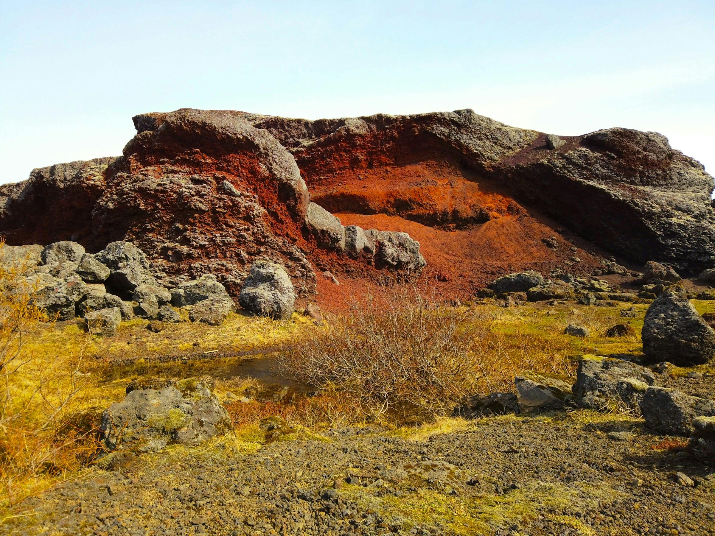
The Rauðhólar Pseudocraters are one of the Capital Region's most unique geological phenomena
4. The Rauðhólar Pseudocraters
Location: The Rauðhólar protected area are at the south-eastern boundary of the Capital Area where the South Iceland part of The Ring Road begins.
Located in the Elliðaárhraun lava field at the Eastern boundary of Reykjavík, a unique geological formation, the Rauðhólar pseudocraters are found. Rauðhólar, or the "Red Hills," are a group of pseudocraters or rootless cones, which are a rare type of volcanic feature both on Earth and in planetary geology. Pseudocraters form when hot lava flows over a wet surface, causing steam explosions that create crater-like formations without a magma conduit beneath them, hence the term "rootless." These formations are exceptionally rare on a global scale, and some of the most well-known examples of such geological features can be found in Iceland. Iceland's unique geology provides excellent conditions for the formation of pseudocraters, making it a key location for studying these phenomena. Additionally, similar structures have been identified on Mars through satellite imagery and rover explorations, indicating past volcanic activity and the presence of water or ice beneath the surface. This comparison underscores the importance of studying pseudocraters in Iceland to understand volcanic processes on other planets.
About 5,200 years ago, a significant shield volcano eruption occurred east of the Bláfjöll mountains. The source crater is called Leitin, and the resulting lava flow is known as Leitarhraun. The main flow of the lava headed southwards, reaching the sea near what is now the town of Þorlákshöfn. Another branch of the lava flowed north and westwards to the Elliðavatn lake depression, and through the course of the Elliðaár rivers to the sea. As the lava traversed wetlands and a shallow lake, steam explosions occurred when the lava overlaid waterlogged sediment layers, resulting in the formation of a cluster of tuff and scoria cones. These hills cover an area of about 1.2 square kilometers. Approximately one-third of these cones have been excavated due to mining activities in the past but it's estimated that there were originally about 150 cones. However, the mines offer a valuable opportunity to examine the internal structure of these pseudocraters.
What makes Rauðhólar particularly striking is its vivid red color, a result of the oxidation of the iron in the scoria from which the hills are formed. This distinct hue contrasts beautifully with the surrounding mossy green landscape, offering a stunning visual experience.
Today, Rauðhólar hills are a protected natural monument at the Northern edge of the Heiðmörk recreational area and a popular destination for both tourists and locals.
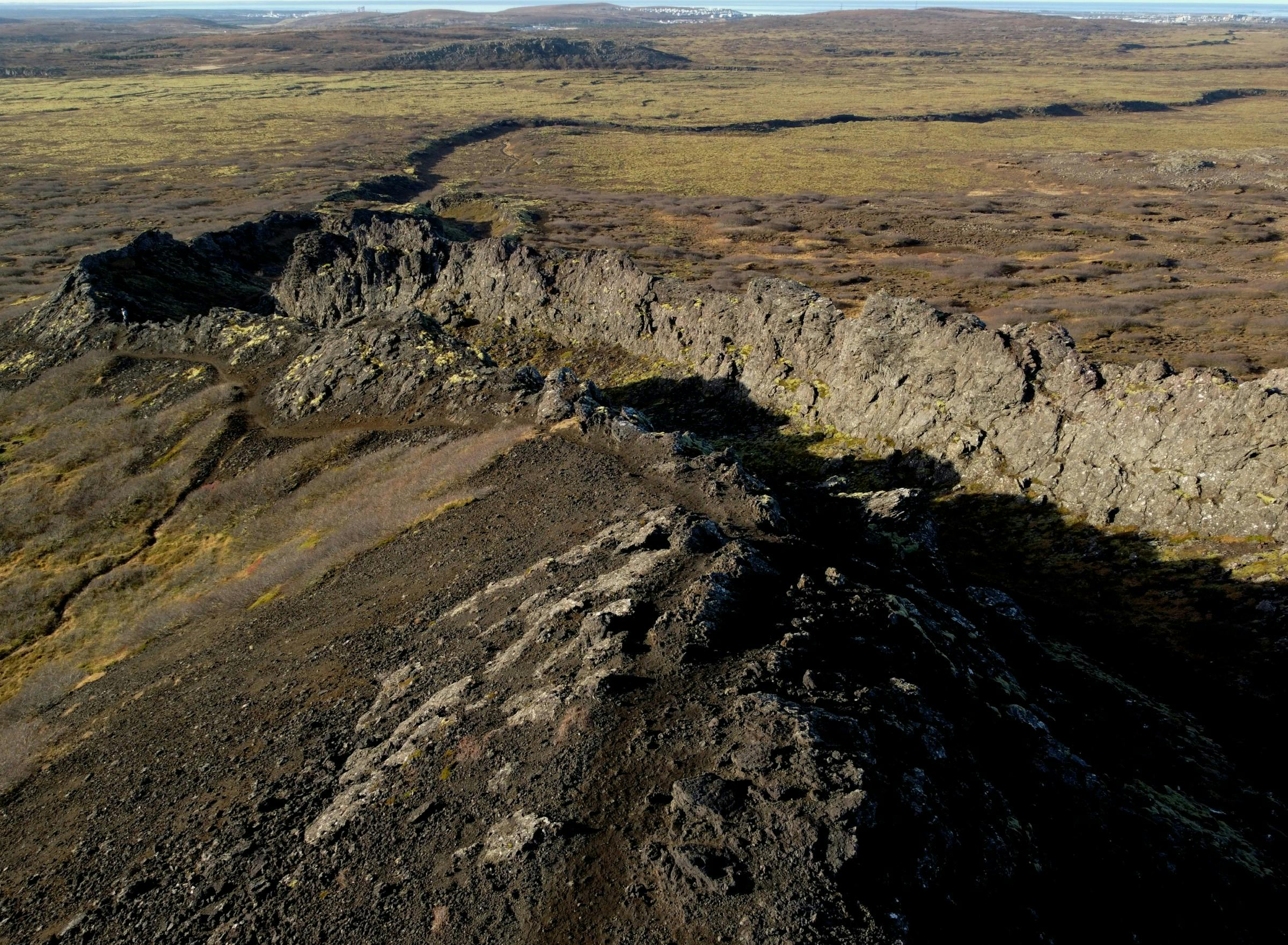
The Búrfell lava channel hike brings you through exotic volcanic landscapes in the Capital Region
5. Búrfell Crater and Búrfellssgjá Lava Channel
Location: The path to Búrfell begins at this car park on the southern part of Heiðmörk recreational area.
! Be aware of crevasses that may be hidden by snow or vegetation
At the Southern part of the Heiðmörk recreational area lies the Búrfellsgjá Lava Channel that around 8000 years ago carried a lava stream from the Búrfell volcanic crater. The channel is easily accessible and a popular hiking path leads from the car park along the channel and up to the 180 m tall crater. The hike is about 6 km and you should set aside at least 2 hours to explore the location.
At the beginning of the hike, a stairs lies down a prominent normal fault into a rift valley. This is clear evidence of the rift zone between the spreading continents of North-America and Eurasia that has cut the lava channel in later tectonic events.
Búrfell is a tuff ring/tephra cone type of volcanic crater called 'eldborg' in Icelandic. The crater, standing 180 meters above sea level, is composed of scoria and lava spatter. The surrounding lava field, collectively named Búrfellshraun, dates back to about 8,000 years ago. From Búrfell, three major lava flows have reached the sea. The largest flow descended along Vífilsstaðahlíð, reaching the sea at Arnarnesvog. Another flow headed towards Kaldárbotnar, then down past Ásfjall, finally entering the sea at Hafnarfjörður. The third lava flow passed south of Kaldárbotnar, reaching the sea at Straumsvík, though it is now mostly covered by younger lava fields. Several neighborhoods in Hafnarfjörður and Garðabær are built upon this lava field.